Hello, I have arrived back from the relaxing, but eventful reading week to update the status on my project.
As highlighted in my last blog, I finally came up with a finalized idea. During the reading week I set myself a pretty large goal, “To complete my animation timeline map for the Royal Hamilton Infantry during World War 2.” I can say with my pride still in tact that I have not met that goal. BUT! I personally believe I made a large step towards completing it even with obstacles I faced.
First obstacle: I downloaded, and installed the YellowJacket software to begin my animation section of my project. The program titled, “Sting Editor” was a much more complicated tool then I first anticipated. After finishing a few tutorials, and rummaging through the tools of the software I unfortunately realized it did not have the visual integration I wanted. String Editor is fantastic to accomplish multiple educational projects across multiple fields of study, but I wanted to do something a little more visually appealing. The program lacked a zooming feature, and it presented a lot of boundaries where creativity was concerned. I wanted my animation map to be appealing, and educational. Unfortunately, string editor lacked the appealing aspect of my project. Don’t get my wrong, I found the String editor a very helpful tool, and I people creating animated maps to give it a go.
Solution to my obstacle: Instead of using Sting Editor, I went to a much more complicated program Adobe After-effects. I have years of experience with this program, but I first wanted to branch out to other programs such as Sting Editor. Using After-effects is a great way to animate objects, and used my thousands of professionals in advertising, Ad companies and several different business organizations. Whats great about After-effects is that it can be used for multiple different academic fields, and yes even History.
Here is my process thus far:
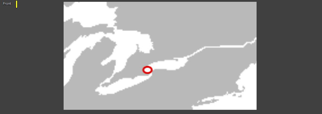
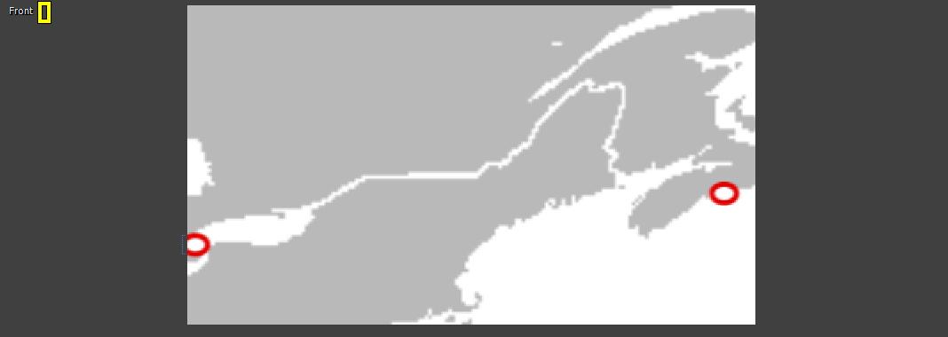
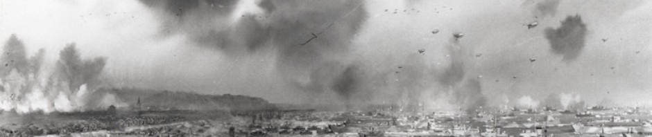
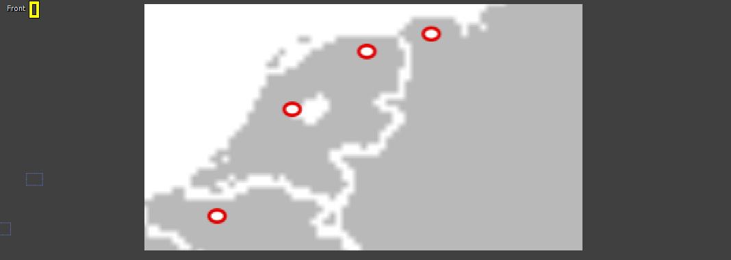 The figure above shows a portion of Continental Europe. More specifically, it shows England, coast of France, and Belgium.
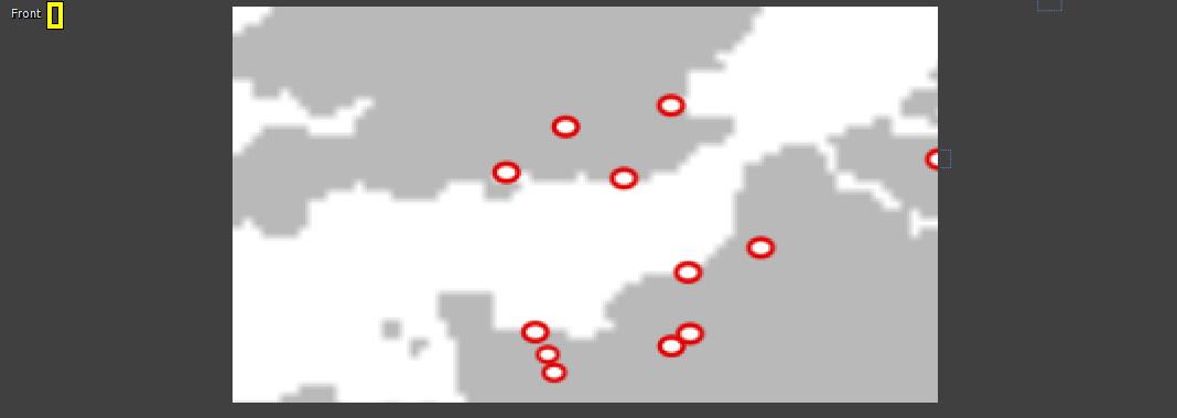
The dots represent Towns/bases/ports and cities where the Royal Hamilton Infantry traveled to during World War 2. Although it doesn’t look like much, every one of those dots is animated, and has programmed pathways for designated icons.
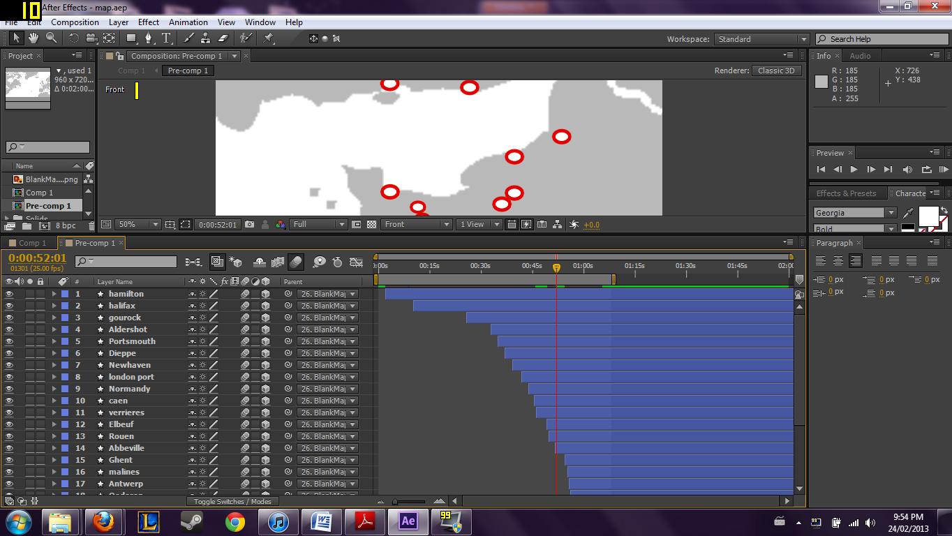
As you see in the picture above, there are several different pathways assigned for each city. Will not lie, this took a substantial amount of time, but it was a great experience.
As I write this blog I am working on this map. I hope to have a fully rendered preview of my map for my project proposal on Tuesday!
See you in class!
